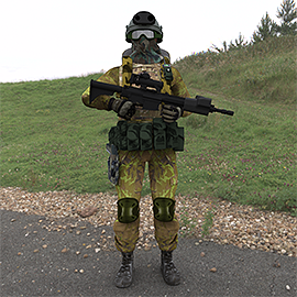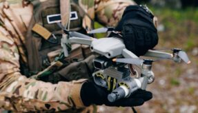
The latest technology in wearable sensor technology has been successfully demonstrated to the Dstl by Roke Manor Research.
These ground-breaking Dismounted Close Combat Sensors (DCCS) are the result of collaboration between Dstl and industry partners Roke, QinetiQ and Systems Engineering and Assessment (SEA). The technology has been designed to help troops navigate without reliance on GPS, as well as automatically detecting threats and sharing information to help protect troops and increase operational effectiveness.
Losing GPS signal could be a case of ‘life or death’ for troops rather than late arrival to an interview for most of us. Commanders would lose the ability to monitor their troops’ location and wider situational awareness is withdrawn from those on the ground. Therefore development of this technology is vitally important for the defence sector.
The new technology uses inertial and visual navigation sensors, combined with clever algorithms to provide 3D navigation data when GPS signal is not available, such as when a signal is lost in built-up urban environments or if the signal is being jammed.
Taking the last known GPS location, DCCS combines information from visually tracked features captured by a helmet camera and inertial sensors, accurately calculating where an individual is, and allowing commanders to track troops even in buildings and tunnels. With not only the location of personnel available, but inertial and magnetic sensors showing which way the weapon is pointing, the technology will help prevent ‘blue on blue’ incidents where troops are mistaken for enemy forces.
The system will also help in other situations, such as identifying the location of injured colleagues, civilian locations and potential landing sites.
A combination of camera, laser and orientation sensors mounted on the personal weapon, will allow targets to be highlighted to other troops, unmanned aerial vehicles and aircraft at the press of a button.
Commenting on the DCCS programme, Ken McEwan, the principal project engineer at Dstl, said: “This has been a very complex and technically challenging project. Despite these challenges there is no doubt that the demonstration programme has been very successful. It has shown that the concept works and that it has civilian and military applications.”
Roke’s lead engineer on the DCCS project, Mark Coleman, also said: “We independently considered 252 fledgling technologies from across industry, academia and beyond, before developing, distilling and fusing them to create the concept of an integrated wearable sensor system, which we then built and trialled. In addition to providing military advantage, we’ve also seen how DCCS lends itself as a testing platform to bring technology to the frontline faster.”
DCCS is expected to be on the frontlines by 2020.
As with many technological advances initially designed for the Armed Forces, it’s not just troops that could benefit from this technology. It has significant implications for the civilian world too with the potential to aid the emergency services in navigating within smoke-filled buildings and the automotive sector in providing a highly accurate 3D reconstruction of car accidents.
If you would like to join our community and read more articles like this then please click here
Dstl frontline GPS Innovation Roke Manor Research sensor soldiers technology


