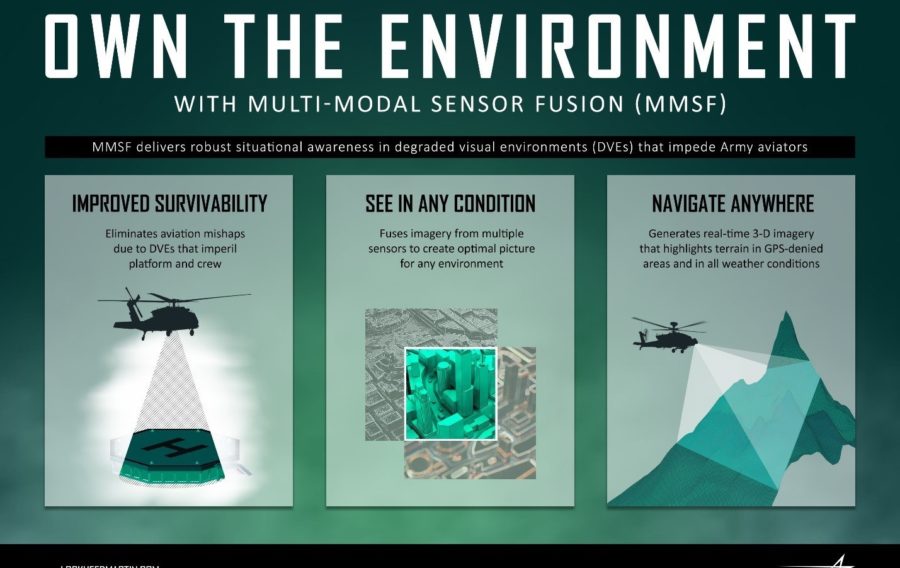
Lockheed Martin has secured a $12 million contract from the US Army to develop a Multi-Modal Sensor Fusion (MMSF) testbed for rotary-wing aircraft.
Under the service’s Night Vision and Electronic Sensors Directorate (NVESD), the company is developing sensor fusion and integration technologies that enhance rotary-wing aircraft survivability and enable pilots to navigate safely in all environments, even when GPS is unavailable.
The MMSF algorithms blend data from multiple sensor types to restore a pilot’s situational awareness in degraded visual environments (DVEs).
During the 40-month effort, Lockheed Martin engineers will integrate government-furnished sensors in a reconfigurable, open-architecture testbed that supports the development of DVE systems for rotary-wing aircraft. Other activities include refining multi-modal fusion techniques and real-time 3-D mapping, and implementing symbols and cues for pilot sensor displays.
MMSF blends sensor data to generate real-time 3-D terrain maps of the area around the aircraft—maps that can identify and highlight obstacles to improve situational awareness for pilots, mission commanders and other platforms. Potential recipients of such capabilities include existing Army helicopters and Future Vertical Lift solutions.
Paul Lemmo, Vice President of Fire Control/SOF CLSS at Lockheed Martin Missiles and Fire Control said: “Current Lockheed Martin fire control systems enable pilots to own the night. Our next-generation MMSF technology will help them own the environment as well. Our work with NVESD and other DVE stakeholders will enable helicopter aircrews to operate more safely and effectively in even the most challenging visual environments.”
image © PRNewsfoto/Lockheed Martin
If you would like to join our community and read more articles like this then please click here.
Lockheed Martin Multi-Modal Sensor Fusion rotary-wing aircraft US Army


